NobleProg delivers high-quality Spatial Analysis training courses in Berlin, the dynamic heart of Germany's tech and innovation sector. Participants benefit from expert-led instruction tailored to the professional needs of the capital's diverse industry landscape. Join our Berlin-based programs to enhance your skills with hands-on learning experiences in a world-class urban environment.
Offered both online and on-site, our instructor-led live Spatial Analysis courses (also referred to as Spatial Statistics, Spatial Analytics, Geospatial Analysis, Geospatial Analytics, Geo-Spatial Analysis, and Geo-Spatial Analytics) utilize interactive discussions and hands-on exercises to demonstrate the practical application of spatial techniques. Participants learn to use specialized software for rendering maps, processing spatial data, and applying analytical methods to terrestrial or geographic datasets, with a particular focus on Geographic Information Systems (GIS) and geomatics.
Spatial Analysis training is available in two formats: "online live training" and "onsite live training". Online live training, often called "remote live training," is conducted through an interactive remote desktop session. Onsite live training can be delivered directly at your customer premises in Berlin or at NobleProg's corporate training centers located in Berlin.
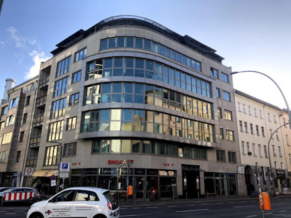
Our training facilities are located at Brückenstr. 4 in Berlin. Located on the fourth floor of a well-kept office building, our premises offer enough space for successful training courses in the heart of Berlin, within walking distance of the Jannowitzbrücke station.
Directions
The NobleProg training facilities are located in the heart of Berlin's Mitte district, just one underground station from Alexanderplatz, one of the centres of this vibrant city. By public transport you can reach us either by underground line U8 to Jannowitzbrücke station, followed by about 100 meters on foot.
Parking
Cars can be parked in the area along Brückenstr. and the nearby side streets, even if you may have to search for a moment. There is no charge for parking.
Local Amenities
Around the Rosenthaler Platz there are numerous small restaurants and shops where you can eat well and cheaply. There are also some hotels close by if you need accommodation for the training.
Our training facilities are located at Dianastrasse 46 in Potsdam-Babelsberg.
Our spacious training rooms are located directly opposite the Filmstudios Babelsberg and offer optimal training conditions for your needs.
Arrival
The NobleProg training facilities are conveniently located near the Medienstadt Babelsberg railway station,
and the A115 motorway is also easily accessible.
Parking
Parking is available in the surrounding streets around our training rooms.
Local Services
Potsdam offers numerous hotels and restaurants and is easily accessible thanks to its well-developed public transport system.
This instructor-led training in Berlin empowers intermediate GIS professionals with advanced skills in ArcGIS Pro Plus. Participants will gain mastery over 3D modeling, spatial data analysis, and Python automation to construct robust geospatial workflows suited for enterprise environments.
This live, instructor-led training, delivered either online or on-site, is designed for GIS professionals and analysts of all skill levels, from beginner to advanced, who seek to leverage ArcGIS effectively for data visualization, spatial analysis, and managing geospatial projects.
Upon completing this training, participants will be capable of:
Managing geospatial data by navigating ArcGIS tools.
Creating and customizing maps utilizing layers and attributes.
Executing advanced spatial analysis and geoprocessing tasks.
Automating workflows through ModelBuilder and Python.
This live, instructor-led training, delivered in Berlin (either online or onsite), is designed for advanced GIS professionals. The program focuses on enhancing spatial analysis capabilities, conducting thorough geostatistical evaluations, and applying advanced 3D modeling techniques to facilitate effective decision-making and problem-solving in practical settings.
By the conclusion of the course, participants will be able to:
Develop advanced skills in spatial analysis techniques using ArcGIS Pro.
Utilize Python scripting for automation and complex data processing.
Apply spatial modeling for problem-solving in real-world scenarios.
Conduct geostatistical analysis for advanced data interpretation.
Integrate external data sources and leverage 3D spatial data analysis.
This instructor-led, live training in Berlin (online or onsite) is aimed at beginner-level IT support personnel who wish to provide robust support for ArcGIS Enterprise, addressing any anomalies or failures effectively.
By the end of this training, participants will be able to:
Understand the architecture and components of ArcGIS Enterprise.
Learn to install, configure, and manage ArcGIS Enterprise.
Gain skills in troubleshooting and resolving common issues.
Develop proficiency in monitoring and maintaining ArcGIS Enterprise environments.
Master the techniques for backup, recovery, and performance optimization.
This instructor-led, live training in Berlin (online or onsite) is aimed at beginner-level professionals who wish to learn the fundamental concepts and tools of ArcGIS.
By the end of this training, participants will be able to:
Understand the basic concepts of GIS and spatial data.
This instructor-led, live training session in Berlin, offered both online and onsite, is tailored for beginner-level earth sciences and engineering professionals aiming to leverage Python for geospatial analysis within both ArcGIS and QGIS ecosystems.
By the conclusion of this program, participants will possess the skills to:
Master Python syntax and control structures for the efficient execution of geospatial tasks.
Employ Pandas, Numpy, and Matplotlib for comprehensive data analysis and visualization in GIS.
Process and analyze vector data using the Geopandas, Arcpy, and PyQGIS libraries.
Automate geospatial workflows and processes through Python scripting in ArcGIS and QGIS.
Create custom Python-based geoprocessing tools for ArcGIS and QGIS to enhance operational efficiency.
This instructor-led live training, offered in Berlin either online or in person, is tailored for intermediate geographers seeking to refine their skills in spatial analysis, data management, and GIS applications.
By the conclusion of this course, participants will possess the ability to:
Deploy advanced spatial analysis techniques to resolve complex geographical issues.
Administer large-scale spatial databases while maintaining high data quality standards.
Produce dynamic, interactive maps and visualizations for a range of use cases.
Apply programming and automation to improve the efficiency of GIS processes.
This practical training in Berlin focuses on using Pix4D Matic and Survey for photogrammetry. You will learn to process drone data, generate orthophotos, DTMs, and contour lines. Additionally, participants will vectorize point clouds and export deliverables for geological or civil analysis using real-world datasets.
This live, instructor-led training in Berlin, offered online or onsite, is designed for field ecologists and conservation managers seeking to create spatial data projects with ArcGIS.
By the conclusion of this training, participants will have the ability to:
Present spatial data through visual formats.
Apply geostatistical methods to actual data.
Carry out spatial data analysis, processing, and mapping tasks in ArcGIS.
Interpret spatial data for various projects within ArcGIS.
In the dynamic energy sector, combining electrical transient analysis with precise geographic data is now a strategic requirement. Reliance on fragmented data sources currently poses significant operational risks. This intensive 14-day program in Melbourne is structured to close the divide between electrical engineering practices and geospatial management strategies.
In Berlin, this course offers a thorough introduction to QGIS, addressing spatial data analysis, map production, and layer administration. Furthermore, it explores PyQGIS for sophisticated Python integration and plugin development, thereby providing learners with practical GIS capabilities.
Read more...
Last Updated:
Testimonials (2)
Learning that the QGIS and a tool that can used by other different professionals such land survey
Bame Duncan Koko - Bentel Technologies (Pty) Ltd
Course - QGIS for Geographic Information System
How to use open satellites data for real applications
Tshering Dorji - Druk Holding and Investments
Course - Advanced Geographic Information Systems (GIS)
Online Geospatial Analysis training in Berlin, Spatial Analytics training courses in Berlin, Weekend Geo-Spatial Analysis courses in Berlin, Evening Geospatial Analysis training in Berlin, Spatial Statistics instructor-led in Berlin, Evening Geospatial Analysis courses in Berlin, Spatial Analytics coaching in Berlin, Spatial Statistics instructor in Berlin, Spatial Analytics instructor-led in Berlin, Spatial Statistics one on one training in Berlin, Geo-Spatial Analytics classes in Berlin, Weekend Geo-Spatial Analysis training in Berlin, Geospatial Analysis trainer in Berlin, Spatial Statistics private courses in Berlin, Spatial Analytics on-site in Berlin, Online Geospatial Analysis training in Berlin, Spatial Analytics boot camp in Berlin